

Hike into History
Most people know the three state parks in Tennessee's South Cumberland for their outstanding natural features, but there’s a whole other side to the story of the South Cumberland region — a rich and fascinating history of the interaction of people with the land, an interaction going back literally thousands of years, to the first Native Americans who hunted and camped on these lands.
Most people know the parks for their outstanding natural features — the Great Stone Door — the Fiery Gizzard — Foster Falls — the Sewanee Natural Bridge — and much, much more.
But there’s a whole other side to the story of the South Cumberland region — a rich and fascinating history of the interaction of people with the land, an interaction going back literally thousands of years, to the first Native Americans who hunted and camped on these lands.
More recently, it has been a story of European settlers, who saw the rich natural resources of the area as a way to make a living by harvesting timber, extracting coal, and even making moonshine using the crystal clear and pure waters of its streams.
By the mid-20th century, however, visionary local leaders saw that this land had even greater geological, biological and recreational significance and was deserving of being preserved in its natural state for everyone to enjoy, now and for generations to come.
And so it was that in 1971, Tennessee governor Winfield Dunn came to Tennessee’s South Cumberland and saw the rugged beauty of Savage Gulf first-hand. What he experienced moved him to advocate for funding to acquire the most outstanding parts of the South Cumberland region and create the parks we all know and enjoy today.
The stories of all these people form the rich history of South Cumberland’s three state parks. The Friends of the Parks have put together a series of adventures that will allow you to “Hike into History” as you visit some of the most unique and intriguing places where history comes to life in the parks.
These hiking challenges will take you to some of the most beautiful and amazing parts of the parks where, if you look carefully, you’ll see evidence of the activities of all these people from history.
This “Discovery Series” features eight easy-to-moderate, family-friendly, self-guided hikes throughout the parks, to some of the most intriguing and spectacular places where history was made.


“Natural History of Tennessee's South Cumberland” takes you to some of the most spectacular places in the parks. You’ll traverse the breathtaking rock amphitheater at Suter Falls, in Savage Gulf State Park. Cross Fall Creek and make your way down, out of the sandstone “cap” that protects the Cumberland Plateau, through the shale layer and finally into the limestone layers below. There, you’ll come to Horsepound Falls and one of the many caves the water has carved out of the softer limestone.
ROUTE: Begin at the Savage Gulf South trailhead; take the Collins Access Trail to the Collins Gulf Trail to Horsepound Falls; retrace your route back to the trailhead. 5 mile round-trip; moderate to difficult.


“Native Americans in the South Cumberlands” takes you to the mouth of Buggytop Cave in Head of the Crow State Park, one of the largest natural cave openings in Tennessee. Along the way, you’ll come to the top of “the Spur”, looking into Buggytop Cove, and pass a giant sinkhole. Buggytop Cave is actually part of an extensive cave network in this area, and on this trek you’ll visit a second cave entrance, Peter Cave, which is known to have been frequented by Native American hunter-gatherers for many centuries. Please remember that the interior of the cave is off-limits due to the potential for introducing white-nosed bat syndrome into the cave’s bat population.
ROUTE: Begin at the Buggtop trailhead; take the Buggytop Trail to its intersection with the spur trail to Peter Cave and bear left to explore the Peter Cave entrance. Return to the intersection and continue straight ahead to explore the mouth of Buggytop Cave; retrace your steps to the intersection, then turn left to return to the trailhead. 3.5 mile round-trip; moderate to difficult.


On the “Pioneers of the South Cumberlands” route, you’ll get a glimpse of what life was like for the earliest European settlers in this area. Several historic cabins have been preserved in the parks, the most notable of which is the Decatur Savage cabin in Savage Gulf State Park, named for the man whose family gave its name to Savage Gulf.
Decatur Savage and his wife, Fannie Tate, farmed and lived in the bottom of Savage Gulf for many years. The Savage family can trace its presence in “the Gulf” back as far as 1719, when Robert Savage obtained some 250 acres in the area. In the bottom of Savage Gulf the observant hiker can also see remnants of early logging operations; the old Savage Gulf schoolhouse; and other long-abandoned signs of early European settlement.
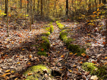
The timber industry was an important part of the South Cumberland economy for many decades. in the deep valleys, well-watered by year-round streams, trees grew to impressive size. Unfortunately, most of the original “old growth timber” was harvested; what you see today in much of the parks is secondary re-growth, dating from the early and mid 1900s.
ROUTE: Begin at the Savage Gulf North trailhead. Take the Stone Door trail out to Stone Door and descend through “the Door” on the Big Creek Gulf trail, down into Big Creek Gulf. At the trail intersection in the bottom of the Gulf, turn left and take the Connector Trail approximately 2.5 miles to the Decatur Savage Cabin, which is on a short spur trail. Retrace your route, taking the Connector Trail, Big Creek Gulf Trail and Stone Door Trail back to the trailhead. 8.5 mile round-trip; moderate to difficult.


On the “Old Growth Forests of the South Cumberlands” hike, however, you’ll be able to catch a glimpse of some of the few areas untouched by the lumberman’s saw. One such location is the grove of short leaf pines on the north rim of Savage Creek, in Savage Gulf State Park, where red cockaded woodpeckers, now endangered, once nested.
In the gorge below, the Werner Big Timber tract is one of the largest old-growth stands of virgin forest in the region, named after Bud Werner, 4th generation descendant of the Werner family who emigrated here from Switzerland in the 1860s and who made much of the land in the parks available for purchase by the State of Tennessee in the 1970s. The Werner family, at one point, held over 15,000 acres of timber, and operated a sawmill and railroad in the area between 1890 and the 1930s.
ROUTE: Begin at the Savage Gulf East trailhead. Take the Savage Access Trail to the Savage Day Loop trail and turn right. At its intersection, leave the Savage Day Loop and take the North Rim Trail approximately 2.8 miles to its intersection with the Mountain Oak Trail; below you will be the Werner Big Timber tract. Continue on the Mountain Oak trail to see the grove of short leaf pines. At the far end of the Mountain Oak Trail, turn right and begin your return journey on part of the North Plateau Trail. At the intersection with the North Rim Trail, follow the signs for the Savage Day Loop, which will return you to the trailhead. 9.5 mile round-trip; easy to moderate.


“Moonshining in the South Cumberlands” takes you to Fiery Gizzard State Park, along the Grundy Day Loop to Schoolhouse Falls, once the site of a moonshine still. Stills were common in the South Cumberland region in the late 19th and early 20th centuries, because this area was prized for its clear and pure water. Along the way you’ll also see the site of the Civilian Conservation Corps camp that was home to the hundreds of young men who built much of the famed Fiery Gizzard trail during the 1930s, as well as the foundation of the CCC’s pump house at the base of Blue Hole Falls.
ROUTE: Begin at the Fiery Gizzard North trailhead. Take the Grundy Forest Loop Trail, bearing right at the first intersection to Schoolhouse Falls. Then continue on to the CCC Camp Loop; walk the loop counter-clockwise, back to the Grundy Forest Loop Trail. Bear right at that intersection and continue past Hanes Hole Falls to the pump house at Blue Hole Falls. Continue on the Grundy Forest Loop Trail, back to its intersection, then right and out to the trailhead. 2.3 mile round trip; easy to moderate.


Coal mining was, for a time, an important part of the economy of this region, from the 1870s until around 1920. “Mining in the South Cumberlands” takes you to the Grundy Lakes area of the parks, where you can see remains of the beehive-shaped “coke ovens” where the coal was heated to produce coal coke, which was later used in blast furnaces to make iron. On the Lone Rock Loop Trail, you’ll also see depressions in the hillsides, the remains of many small, narrow mine shafts, called “dog hole mines” because of their small size.
ROUTE: From the parking area at the Grundy Lakes Historic Area, walk the circumference of the large lake (most of it on paved roads; watch for traffic!) to see the coke ovens and evidence of many abandoned mine shafts. 1.75 mile round-trip; easy.


The discovery of coal gave rise to the appearance of railroads in this area, built primarily to bring the coal to market. “Railroads in the South Cumberlands” will take you to one of these special-purpose railroads, the “Dinky Line”, on the north rim of Savage Creek, in Savage Gulf State Park.. This narrow-gauge railway brought the coal (and later, timber) out of Savage Gulf and over to Palmer, where it was transferred to the Mountain Goat Railroad, part of which has now been converted to a walking and biking trail that spans much of the South Cumberland region. As you walk along the dinky Line, you may still see some of the old cross-ties alongside the trail, which follows the original rail grade for about a mile.
ROUTE: Begin at the Savage Gulf East trailhead. Take the Savage Access Trail to the Savage Day Loop trail and turn right. At its intersection, leave the Savage Day Loop and take the North Plateau Trail approximately 1.3 miles out to the Dinky Line remnants. Retrace your steps on the North Plateau Trail. At the intersection with the North Rim Trail, follow the signs for the Savage Day Loop, which will return you to the trailhead. 6.5 mile round-trip; easy to moderate.


To celebrate the more recent history of the area, “Following in the Steps of Governor Dunn” commemorates the visit by Tennessee's then-governor to the South Cumberland region, after which he became a strong advocate for the creation of what was originally known as South Cumberland State Park. Dunn, who was at the time in a tough battle for re-election, was invited by then-State-Naturalist Mack Prichard to “come and stretch your legs” in Savage Gulf.
Dunn took him up on the idea, and, along with a party of other state officials, toured the gulf by Jeep, horseback, and on foot. Your hike will take you on a portion of Dunn's journey, out to Rattlesnake Point, where you can take in the same “forever wild” views that so impressed the governor 45 years ago.
ROUTE: Begin at the Savage Gulf East trailhead. Take the Savage Access Trail to the Savage Day Loop trail and turn left. Follow the Savage Day Loop out to the Rattlesnake Point overlook. From there you can either complete the Savage Day Loop (returning you to the trailhead) or turn around and retrace your steps to the trailhead. 4 miles either way; easy to moderate.
As you enjoy hiking in the parks, we hope you’ll see the areas you visit in a different light, as you join us on our “Hike into History!”